How do Hurricanes Form?
Meteorologists and Scientists still don’t know all the details as to what exactly causes a Hurricane but they have determined 2 necessary main factors; warm water and winds that don’t change much in speed or direction as they go higher in the atmosphere. Usually, water temperatures must be about 26 degrees Celsius (79 degrees Fahrenheit) or higher for a hurricane to form.
The term used to describe the change in speed and direction with height is “Vertical Wind Sheer”. The lower the Wind Sheer, the more consistent speed and direction are, while a higher Wind Sheer signifies more erratic wind speeds and direction and tend to blow storms apart.
Anatomy of a Hurricane:
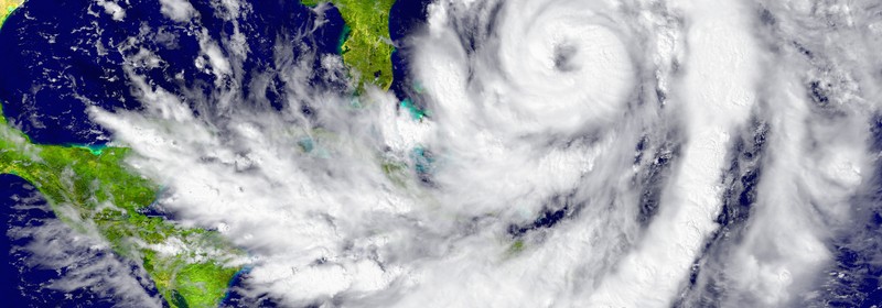
Eye: The “Eye of the Storm” refers to the “hole” in the middle of the Hurricane. In the Eye, winds are light and the sky can often be totally clear.
Eye Wall: The Eye Wall is the ring of thunderstorms swirling immediately around the eye of the storm. The wall is where the strongest winds and rain are the heaviest.
Rain Bands: The rain bands are the spiral bands of thunderstorms that extend out from the wall of the hurricane. These bands make up a majority of the hurricane, as they can stretch for hundreds of miles and can sometimes contain tornadoes.
How are they Categorized?
Hurricanes are placed into categories based upon their wind speed using the Saffir-Simpson Hurricane Scale.
- Category 1: Winds of 119-153 km/hr (74-95 mph) – faster than a cheetah
- Category 2: Winds of 154-177 km/hr (96-110 mph) – as fast or faster than a baseball pitcher’s fastball
- Category 3: Winds of 178-208 km/hr (111-129 mph) – similar, or close, to the serving speed of many professional tennis players
- Category 4: Winds of 209-251 km/hr (130-156 mph) – faster than the world’s fastest rollercoaster
- Category 5: Winds more than 252 km/hr (157 mph) – similar, or close, to the speed of some high-speed trains
How (and why) are Hurricanes Named?
When it comes to naming Hurricanes, there’s actually quite a strict list that the World Meteorological Association assembles. The list of names is rotated on a 6-year schedule to avoid repeats and names given to hurricanes that become deadly or extremely costly are retired. (See the full list of names here)
Until the early 1950’s, hurricanes were simply identified by the year and order they occurred in. It was so realized that these identifying numbers were confusing to many, particularly when hurricanes occurred at the same time or closeby, and the use of common names allowed for quicker and easier communication.
In 1953, the US began to use female names to name hurricanes in the pacific. Solely female names were used until 1978 when they began the use of both male and female names. This system was soon adopted by the Atlantic coast in 1979.
(Our thoughts and prayers go out those people and places already affected by Hurricane Matthew. Please stay safe everyone!)


